Background
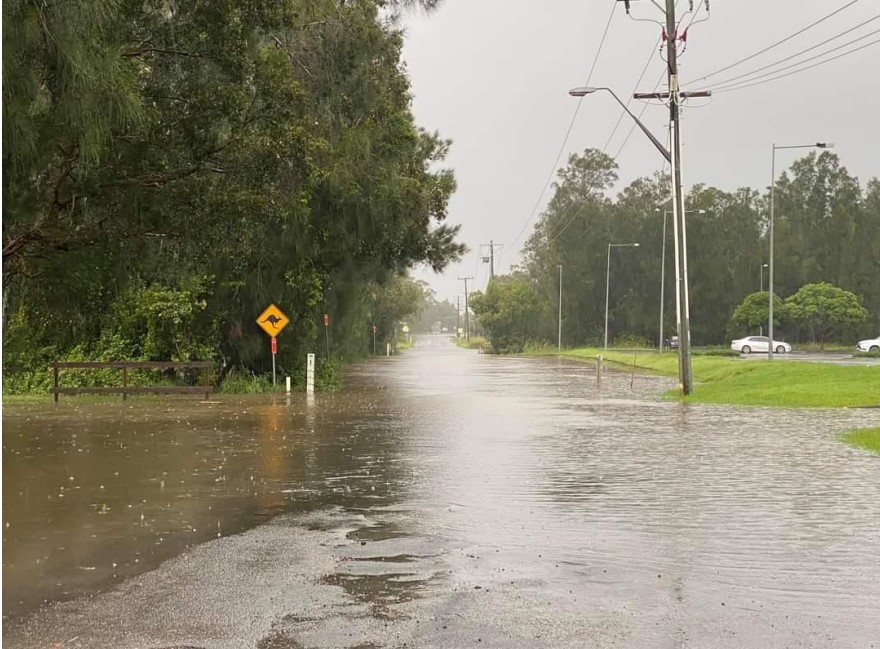
In 2021 Port Macquarie experienced a 1 in 100 year flood event which closed Boundary Street and prevented access to the airport which hindered emergency service personnel providing emergency support to Port Macquarie. Port Macquarie Hastings Council are preparing to lodge a Development Application for the duplication of the Boundary Street connection between the Hibbard Ferry Terminal and the Port Macquarie Airport.
The objectives of the development:
- Provide flood immunity against the 20-year flood event
- Improved access and safety for pedestrians and cyclists
- Improved efficiency for vehicles accessing the airport
- Provide necessary transport infrastructure required by the expanding population
- Improve traffic flow on Boundary Street
- Part of Council’s commitment to long term future transport planning
Port Macquarie Hastings Council are preparing to lodge a Development Application for the duplication of the Boundary Street connection between the Hibbard Ferry Terminal and the Port Macquarie Airport. Barr Planning have been engaged by Council to prepare a Social Impact Assessment (SIA) to accompany the Development Application.
The purpose of the SIA consultation is to:
- Inform the local community of the development
- Understand what is important to the community
- Seek feedback in relation to positive or negative social impacts resulting from the proposed development
Duration of Consultation
Monday 31 March 2025 – Sunday 27 April 2025
Face to Face Consultation
Drop-in Session:
Monday 14 April 2025
5.00pm – 6.30pm
Port Macquarie Indoor Sports Stadium
Lounge Area
1 Hibbard Drive, Port Macquarie
Project Information
Site Location: Boundary Street from the Hibbard Ferry Terminal to the Port Macquarie Airport
Proposed Development: The development works include:
- Widening Boundary Street to provide two traffic lanes on each side of the road
- Installing a new roundabout to the southern end of Boundary Street
- Providing a shared path on the west side
- Providing embankment or retaining wall on both the east and west sides
- Renewed drainage along Boundary Street
- Replacing the existing culvert crossing
- Reconstructing and resurfacing the road base on Boundary Street
- Upgrading driveways to existing properties impacted by the works
- Upgrading the Hibbard Ferry approach to the north of Hastings River Drive with the installation of an information bay and queuing lanes
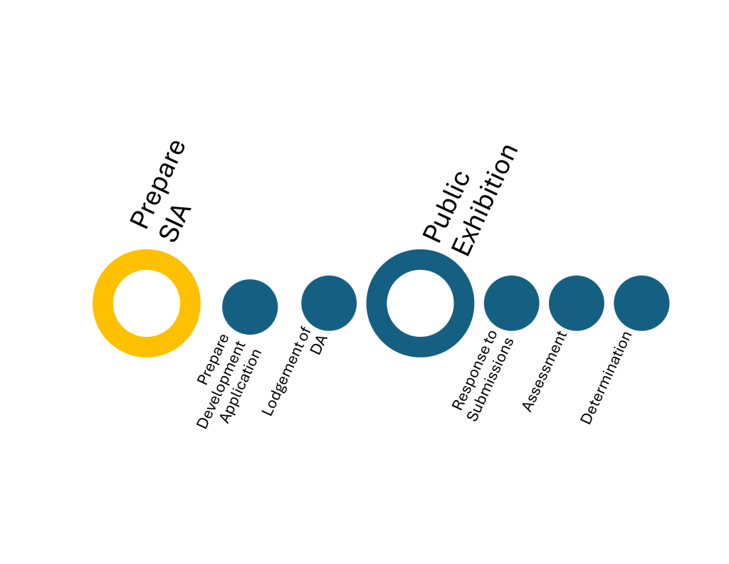
Project Timeline
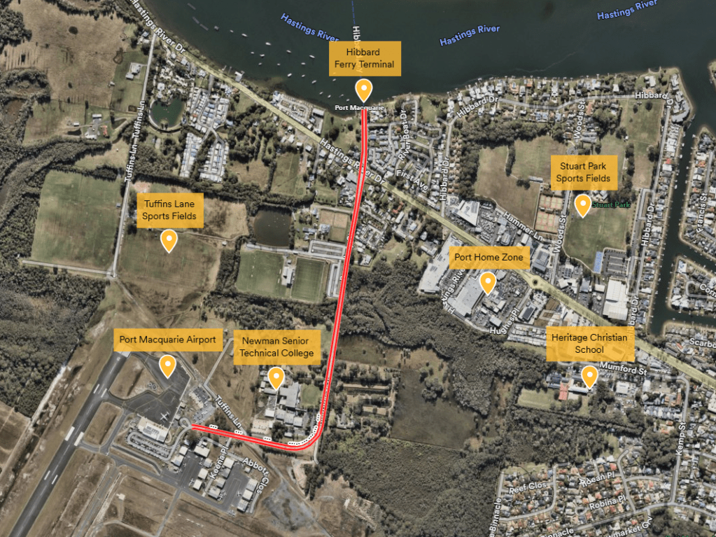
Location Map
Boundary Street development location show in red.
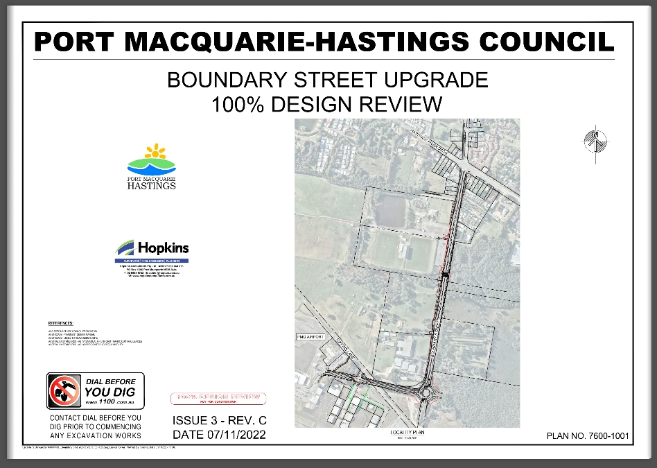
Project Plan
Stakeholder engagement is a key aspect of the consideration of a project. There will be several opportunities for the community to have their say of the project. A copy of the project plan can be viewed by clicking here or the image below:
Survey
The purpose of the survey is to establish the social context of the locality without the current project. The survey seeks to document:
- the existing social environment, conditions and trends
- the community’s perception of the proposed development
- the community’s key social (positive and negative) impacts associated with the development

Contact
![]()
Barr Planning
02 4037 2451
